
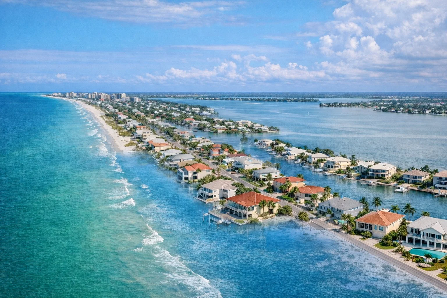
What Is an Elevation Certificate and Why Does It Matter on the Gulf Coast?
If you're considering buying property on Florida's Gulf Coast—whether as a retirement destination, vacation home, or investment—you've probably heard the term "elevation certificate" mentioned by lenders, real estate agents, or insurance professionals. It might seem like just another document in a stack of paperwork, but for Gulf Coast homebuyers, especially those concerned about long-term asset protection and insurance costs, understanding elevation certificates can mean the difference between a sound financial investment and an unexpectedly costly surprise.
This guide explains what an elevation certificate is, why it's critical for Gulf Coast properties, and how it directly affects flood insurance premiums—sometimes saving you thousands of dollars over the life of your ownership.
What Is an Elevation Certificate?
An elevation certificate is an official document prepared by a licensed surveyor that measures and certifies the elevation of a structure's lowest floor (or lowest piece of equipment) relative to a fixed, known reference point—usually the National Geodetic Vertical Datum (NGVD) or the North American Vertical Datum (NAVD88). Think of it as a surveyor's formal certification that says, "This is exactly how high your house sits."
The certificate documents several key measurements:
The lowest floor elevation of your home or building
The Base Flood Elevation (BFE) for your property's location, as determined by FEMA
The relationship between the two: how many feet above or below the BFE your lowest floor sits
The property's flood zone (AE, VE, X, etc.) as shown on the FEMA Flood Insurance Rate Map (FIRM)
Existing fill or mitigation measures that may affect flood risk
That last measurement—the difference between your lowest floor and the Base Flood Elevation—is the one that changes everything when it comes to insurance costs and long-term financial planning.
Elevation Impact on NFIP Flood Insurance Premiums
Example comparison for a single-family home in FEMA AE flood zone
Note: Premiums are illustrative and vary by property, lender, insurance type, and current NFIP or private insurer rates. Consult your insurance agent for exact quotes.
Understanding Base Flood Elevation (BFE) and Why It Matters
The Base Flood Elevation is FEMA's estimate of the water level that would occur during a 1-in-100 year flood event (also called a "100-year flood"). It's not a prediction of when a flood will happen—it's a statistical measure of flood risk. On FEMA's Flood Insurance Rate Maps (FIRMs), the BFE is marked on properties in high-risk flood zones (such as AE or VE zones).
Here's what makes BFE so important for Gulf Coast buyers:
Location matters more than you think. Two homes on the same street in the same flood zone can have dramatically different flood insurance premiums based on whether their lowest floors sit above or below the BFE. A home with its lowest floor two feet above the BFE might pay significantly less in annual flood insurance than a home whose lowest floor is at or below the BFE—even though they may look identical from the curb.
This is where an elevation certificate becomes your financial compass. Without one, lenders and insurers may make conservative estimates about your home's elevation, potentially overcharging you for flood insurance. With an accurate certificate, you can prove exactly where your home sits and often negotiate lower premiums based on that certified data.
For Retirement and Cash Buyers
If you're a cash buyer or semi-retired relocating to Florida, this matters even more. You may not need a mortgage, which means you might skip obtaining an elevation certificate—but you absolutely still need flood insurance if your property is in a Special Flood Hazard Area (SFHA). An elevation certificate directly reduces your insurance costs, protecting your monthly fixed income and preserving more of your asset for estate planning and legacy goals.
When Do You Need an Elevation Certificate?
The simple answer: if you're buying a property in a high-risk flood zone (AE, VE, or similar), your lender will require an elevation certificate before closing. But even if you're paying cash or your property is in a lower-risk zone, an elevation certificate is still worth obtaining.
Required Situations
Financed purchase in a Special Flood Hazard Area (SFHA): Mortgage lenders require an elevation certificate to ensure your home is properly insurable and to avoid lending on an underwater asset.
Flood insurance claims or renewals: Insurers may require a current elevation certificate before issuing a policy or to verify premium rates.
Property modifications or elevation work: If you've elevated your home, added fill, or modified the structure, an updated elevation certificate proves the change to insurers.
FEMA's estimated elevation seems incorrect: If you suspect FEMA's BFE data is wrong for your property, an elevation certificate allows you to request a Letter of Map Change (LOMC) to potentially move your property to a lower-risk zone.
Recommended (But Not Required)
Cash purchases in flood zones: Prove your elevation to get the most accurate insurance quotes upfront.
Refinancing an existing home: An updated certificate may qualify you for lower premiums under new rating systems like FEMA's Risk Rating 2.0.
Estate or investment property planning: Accurate elevation data supports long-term asset valuation and insurance cost forecasting.
How Elevation Certificates Affect NFIP Premiums
This is where elevation certificates deliver real, measurable value.
Under FEMA's National Flood Insurance Program (NFIP) and the newer Risk Rating 2.0 premium structure, flood insurance premiums are calculated based on multiple factors, including property location, flood zone, construction type, and—critically—the elevation of the lowest floor relative to the Base Flood Elevation.
The math is straightforward: The higher your lowest floor sits above the BFE, the lower your risk, and the lower your premium. A home with a lowest floor two feet above BFE will typically pay substantially less than a home at or below BFE. Some homeowners have saved $1,000 or more annually by obtaining an elevation certificate that corrected FEMA's elevation estimate.
Without an elevation certificate, insurance companies often apply conservative (higher) premiums based on default assumptions. With a certified, accurate measurement, you can claim the premium rate your actual elevation deserves.
Private Flood Insurance
If you're shopping for private flood insurance (which many Gulf Coast buyers now do as an alternative to NFIP), elevation certificates are equally important. Private insurers rely on certified elevation data to price risk accurately, and many will offer preferred rates to properties with current, certified elevation documentation.
How to Get an Elevation Certificate in 5 Steps
Hire a Licensed Surveyor
Contact a surveyor familiar with FEMA elevation certificates in your county.
Schedule the Survey
Surveyor visits to measure lowest floor and tie to USGS benchmarks (30 min–few hours).
Verify Reference Points
Surveyor establishes ties to known elevation data (USGS benchmarks or GPS).
Review the Document
Check all details (address, flood zone, BFE, your elevation) for accuracy (1–2 weeks).
Submit to Lender & Insurer
Provide original certificate to lock in flood insurance premium and complete closing.
How to Get an Elevation Certificate on the Gulf Coast
Step 1: Hire a Licensed Surveyor
Contact a licensed surveyor in your county or municipality. Many surveying firms on the Gulf Coast specialize in elevation certificates and understand local flood zone complexities. Ask for one who is familiar with FEMA's current elevation certificate format and your specific flood zone.
Step 2: Schedule the Survey
The surveyor will visit your property to measure the elevation of the lowest floor, the lowest equipment (such as mechanical units), and any existing fill. For pilings or stilts homes (very common on the Gulf Coast), they'll measure to the underside of the first floor above the pilings. Plan for a visit that may take 30 minutes to several hours, depending on property complexity.
Step 3: Reference Point Verification
The surveyor will tie their measurements to a known vertical datum using USGS benchmarks or GPS. The closer your home is to an established benchmark, the faster and potentially less expensive the process.
Step 4: Review and Receive
Once the survey is complete, you'll receive the elevation certificate document, typically within 1–2 weeks. Check it carefully to ensure all information (property address, flood zone, BFE, your elevation) is correct. Any errors should be corrected before submission to your lender or insurer.
Step 5: Submit to Lender and Insurer
Provide the original elevation certificate to your mortgage lender and flood insurance agent. They'll use it to finalize your insurance premium and complete underwriting.
Cost Expectations
On the Gulf Coast, elevation certificates typically cost $300–$600, though prices can range from $150 to over $1,000 depending on:
Local benchmark availability (closer benchmarks = lower cost)
Property size and complexity (pilings, multiple structures, difficult access = higher cost)
Rush delivery needs (faster turnaround costs more)
Whether you need additional documentation (such as a Letter of Map Change)
For most Gulf Coast retirement or investment buyers, the cost is easily recouped through lower flood insurance premiums—sometimes within a single year.
What If Your Property Doesn't Have an Elevation Certificate?
If you're buying a second-hand home (which most are) or an older property that was built before elevation certificates became standard, there may be no existing certificate on file.
This is not a dealbreaker. You simply obtain a new one. The surveyor will treat it like any other survey—they'll measure your current property as it stands today.
However, if you're interested in a home that was originally built and certified years ago, you may want to verify whether FEMA's BFE has changed since then. Flood maps are updated periodically, and the BFE in your area may have been revised upward due to new hydrology data or climate considerations. An updated elevation certificate reflects current conditions and current BFE data, ensuring your insurance is priced correctly under today's maps and risk assessments.
Legacy or Missing Documentation
If a property came with an elevation certificate from 10+ years ago, your lender or insurer may ask for an updated one, especially if FEMA's flood maps have been remapped for your area. This is particularly common in Gulf Coast regions where flood data is reviewed frequently due to climate and development changes.
Do You Need an Elevation Certificate?
Quick guide for Gulf Coast property buyers:
YES, Definitely Get One If:
- You're getting a mortgage in a flood zone (lender requires it)
- You're a cash buyer in AE or VE zones
- You want the lowest possible flood insurance premium
- Your property was built on pilings or has unusual elevation
- You're refinancing and want to update your premium
Consider One If:
- You suspect FEMA's elevation estimate is inaccurate
- Your property is in a lower-risk (X) zone but near water
- You're planning to renovate or make major improvements
- You're buying a property where the map has been recently updated
- You want certainty before making a financial commitment
Bottom line: An elevation certificate is a low-cost way to save hundreds or thousands on flood insurance. If you're uncertain, it's almost always worth the $300–$600 investment.
Elevation Certificates and Your Bottom Line
For retirement and investment buyers on the Gulf Coast, elevation certificates are one of the simplest, most direct ways to reduce a major ongoing expense: flood insurance. A few hundred dollars spent on a surveyor's measurement can pay for itself in premium savings within months.
More importantly, an accurate elevation certificate gives you certainty. If you're relocating from out of state, buying for the first time in a flood zone, or managing a fixed retirement income, knowing exactly what your flood insurance will cost—and proving that cost is based on accurate data—is worth far more than the paper itself.
Related reading: For a comprehensive overview of flood zones on the Gulf Coast and how to interpret your flood risk, check out our detailed guide: Guide to Gulf Coast Flood Zones.
Next Steps
If you're seriously considering a Gulf Coast property purchase:
Ask your real estate agent or lender to identify the property's flood zone and Base Flood Elevation
Request an elevation certificate as part of your due diligence, even if not required
Use the certified elevation to shop for flood insurance and compare premiums
Keep the certificate with your property records for future refinances, sales, or renovations
Finding a Local Specialist
If you're new to the area and unsure where to start with elevation certificates, FEMA rating, or understanding your specific flood risk, I'm happy to connect you with experienced local Gulf Coast real estate and insurance specialists who work with relocating buyers like yourself. They'll walk you through every step of the process and ensure you have the documentation you need for a confident, informed purchase. Feel free to reach out, and I'll make a personal introduction.
Disclaimer: This article is provided for educational and informational purposes only. I am a licensed real estate broker in Idaho, not Florida. Nothing in this article constitutes legal, tax, financial, or real estate advice. Before making any property purchase, flood insurance decision, or elevation-related change, consult with licensed professionals in Florida, including a real estate attorney, tax advisor, and licensed insurance agent. Flood insurance rates, FEMA regulations, and local building codes are subject to change. Always verify current requirements with your lender, local building department, and insurance provider.